
Kayaking Lake Pedder to Hike the Frankland Range
For years Col has talked about wanting to kayak on Lake Pedder. We’d looked at this a few times, with a view to potentially including a hike up either Scotts Peak or Mount Solitary. But for some reason, it just didn’t happen until 2021.
After watching Matt Brain’s video Storm at the Citadel, I finally got around to planning a trip.
Access
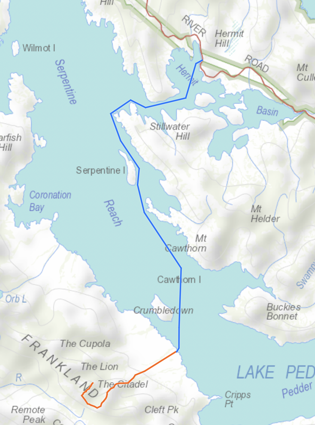
Matt and John had kayaked across to the range from Scotts Peak Dam, but looking at the map, I chose a route from the eastern shore. This saw us depart from a point in Hermit Basin where there is a four-week-drive track down to the water and enough room to park the car off the main road (-42.82919 146.12581).
Although we had perfect conditions, the paddle took us about 4 hours, with minimal breaks. This was no doubt influenced by the slight breeze, as the return trip only took us 3 hours.
Camping
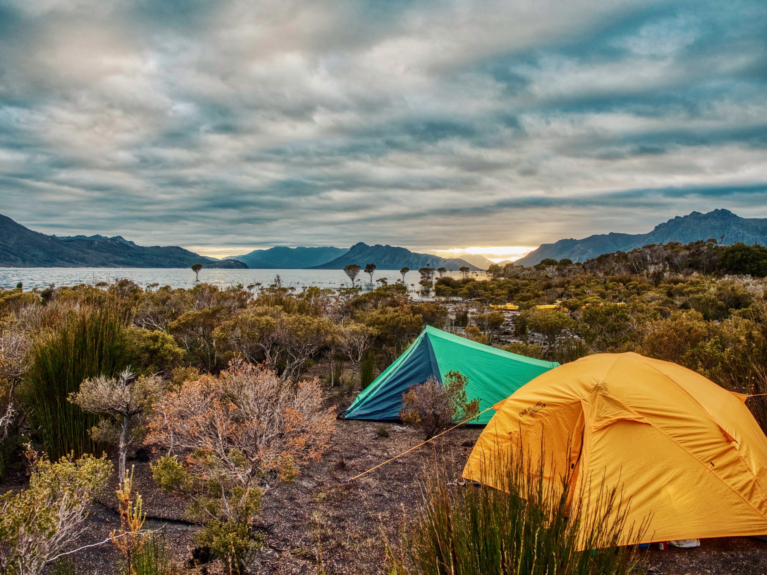
I had assumed we’d find a nice beach on which to camp, having been to Lake Pedder many times before. However, all of the nice beaches appeared to be on the eastern shore. As we were keen to find a spot below Murphys Bluff, our only option was a bit of a mud flat between the water and the button grass plain stretching out to the Frankland Range, although it was beautiful.
Frankland Range
In Matt’s video, he and John had climbed The Citadel and this was our initial target. On starting my research, I found there wasn’t a lot of info about the Frankland Range online, with the few posts about it covering the traverse of the range — a lot longer trip than what we had planned. After pouring over maps and satellite images, I initially planned a route up The Lion, although Matt and John had apparently climbed up via Cleft Peak. On reaching out to Matt, he advised the best access was via Murphys Bluff, which he and John had come down at the end of their visit.
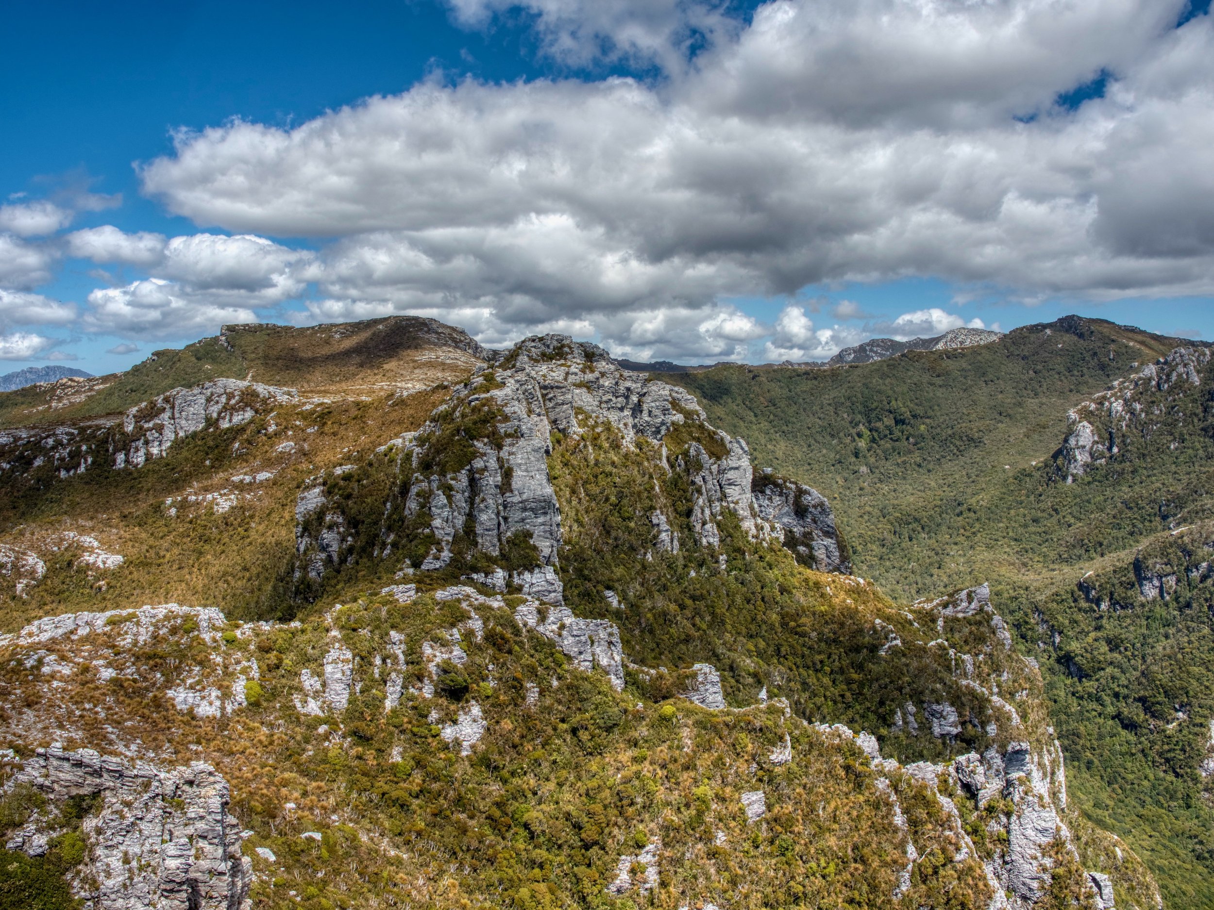
From our camp site, the middle section of Murphys Bluff looked impossibly steep, but we set out and made our way to the top.

On reaching the peak in the photo above, we discovered the true high point required dropping down into another saddle (ridge on the left in the image below) and required a further climb.
Given it had taken us 4 hours hiking to get to this point, we decided that reaching The Citadel was a bigger day than what we wanted, especially knowing we had the return paddle the following day, and were back to work the day after.
Looking at the image above, the route to climb the true high point isn’t obvious, but Matt tells me there is a clear pad all the way up, with Murphys Bluff being a favoured route before Lake Pedder was damned.
In hindsight, we should have camped up on the range, and ideally factored in another night. There is apparently a campsite and water on the main range at Citadel Shelf. However we enjoyed the amazing views from the summit we had reach, and after a lunch stop, made our way back to camp.
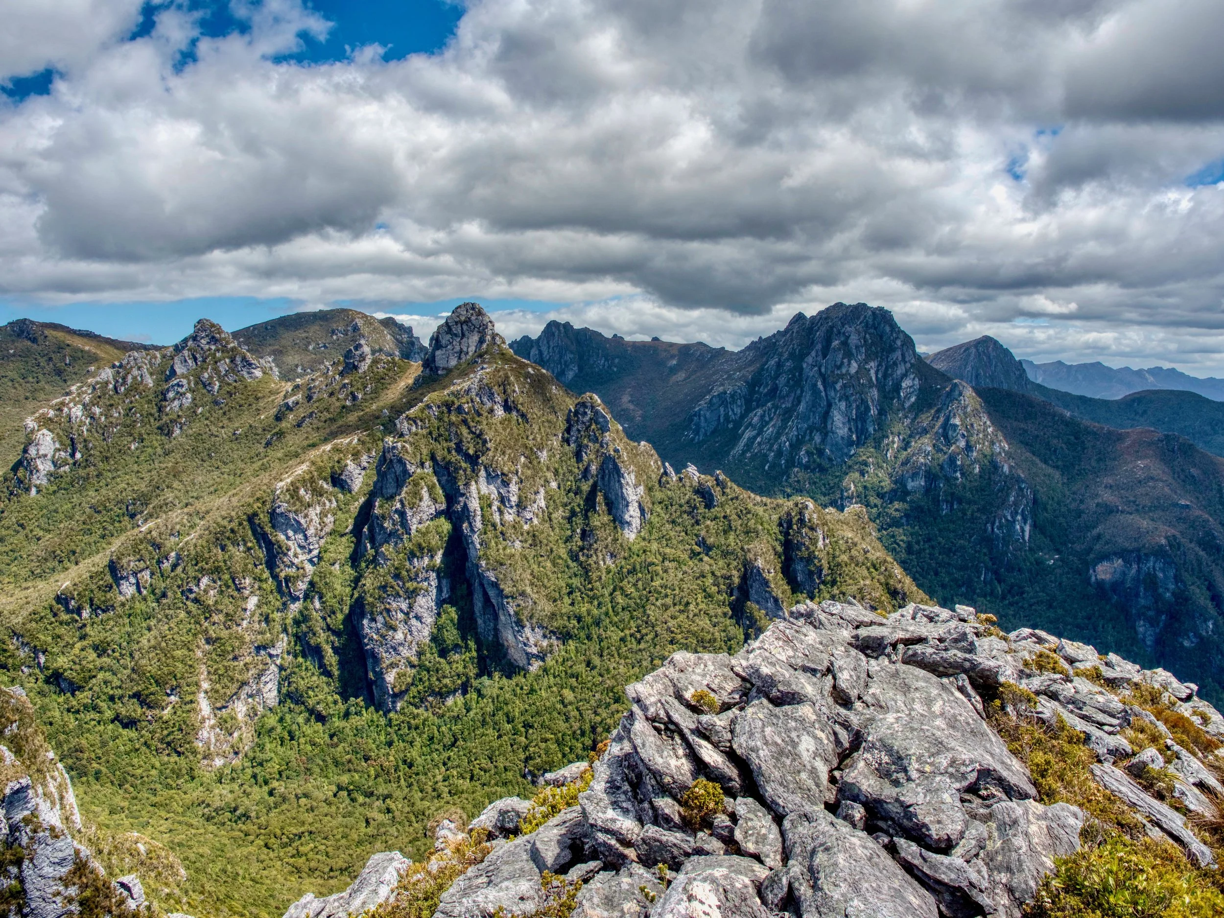
Citadel West (left), Citadel East (centre), and The Lion (right)
In all, it was a fantastic trip, but one that was physically exerting when factoring in the kayaking. However the range is somewhere that I am sure we will visit again one day.