

Miscalculating the Crossing – Packrafting the Crossing and Davey Rivers
As our major trip this year, Col and I ambitiously decided we’d packraft the Crossing and Davey Rivers to Port Davey and finish by walking out on the South Coast Track — a planned fourteen day journey. However, unexpectedly high water on the Crossing saw a bit of a different outcome!
Our expectation was for a low water trip at the end of summer. The river level had reasonably consistently been at a low 300-ish Ml/day at the Davey River gauge, with occasional spikes of up to 1000 Ml/day, which prior trip reports indicated was probably an optimal level. The WikiRiver guide on the river suggested a few days rain in the week prior to a trip was desirable, so we were initially relieved to have 20mm of rain falling at Scotts Peak the night before we departed.
The Track
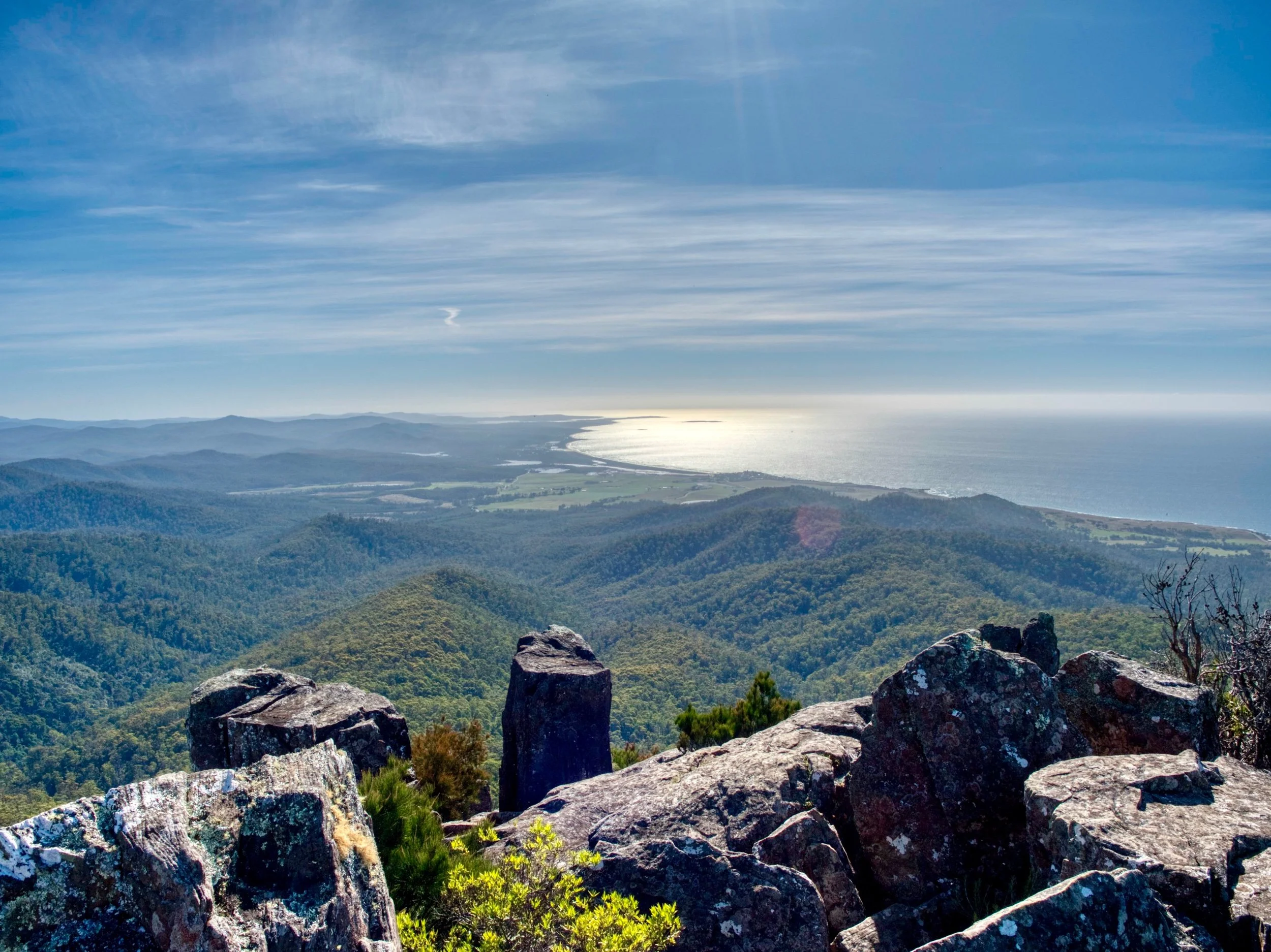
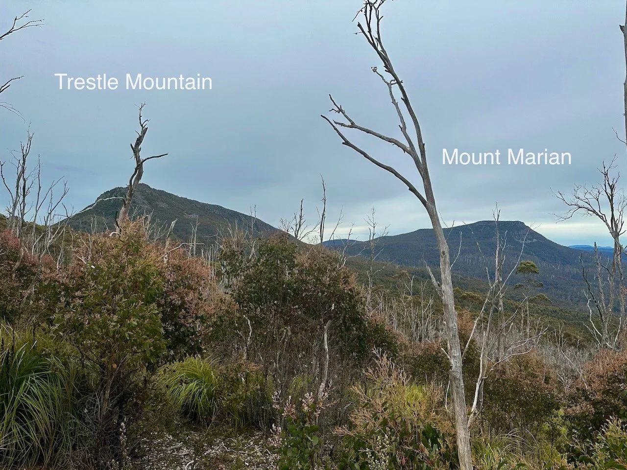
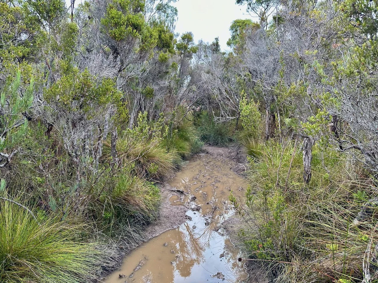
We set out on Sunday the 26th of February 2023 from Huon Campground, below Lake Pedder, walking in on the Port Davey Track. Although the initial part of this track is popular, being the access to the Western Arthurs traverse, the track is pretty poor in many places, with copious mud.
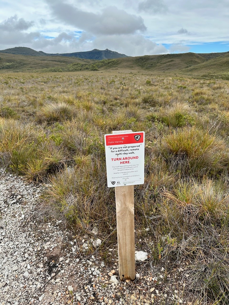
Our planned first night camp was the point where the track crosses the Crossing River — a 20km walk. But slow walking, with 30kg packs holding our rafts, saw us stop at the Alpha Moraine campsite, 13km in.
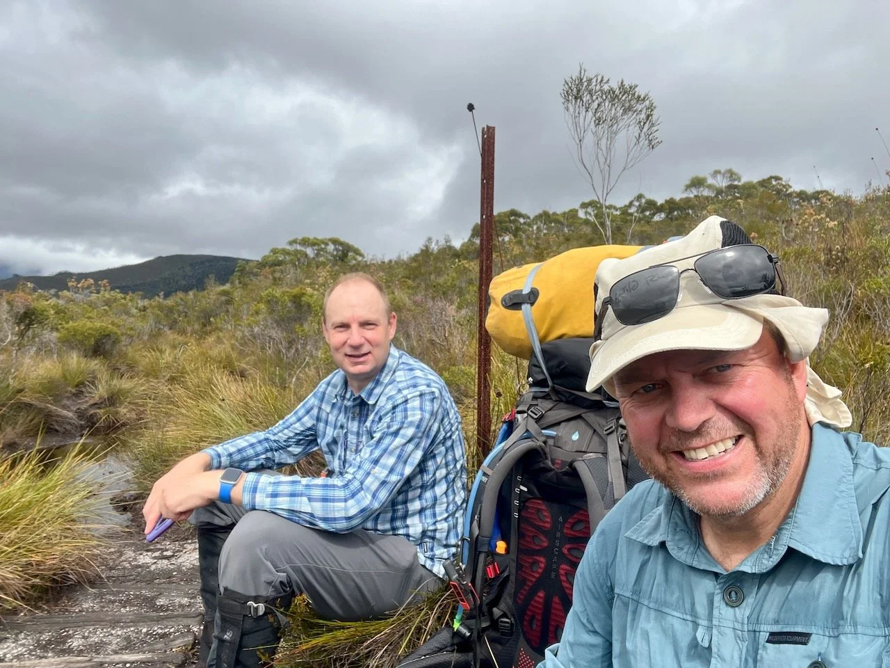
Our target for day 2 had been to walk 5km on from the Crossing River campsite and put in there, avoiding log jams further up, and then paddle the initial 3.5km to the start of the Crossing Gorge and camp. Again, slow progress, plus the additional 7km left over from day one, meant we only made it as far as the put-in point, where we camped on top of the spur that leads down to the river.
The track was a mixture of reasonable and awful to this point, being particularly boggy on the approach to where the track crosses the river.
The water level at this point should have put us on notice for what was ahead. Usually it is possible to wade the section of the river that is crossed by the track, but high flow saw us instead inflate one of the rafts to paddle across a little upstream, due to concern flow at the crossing point was too fast.
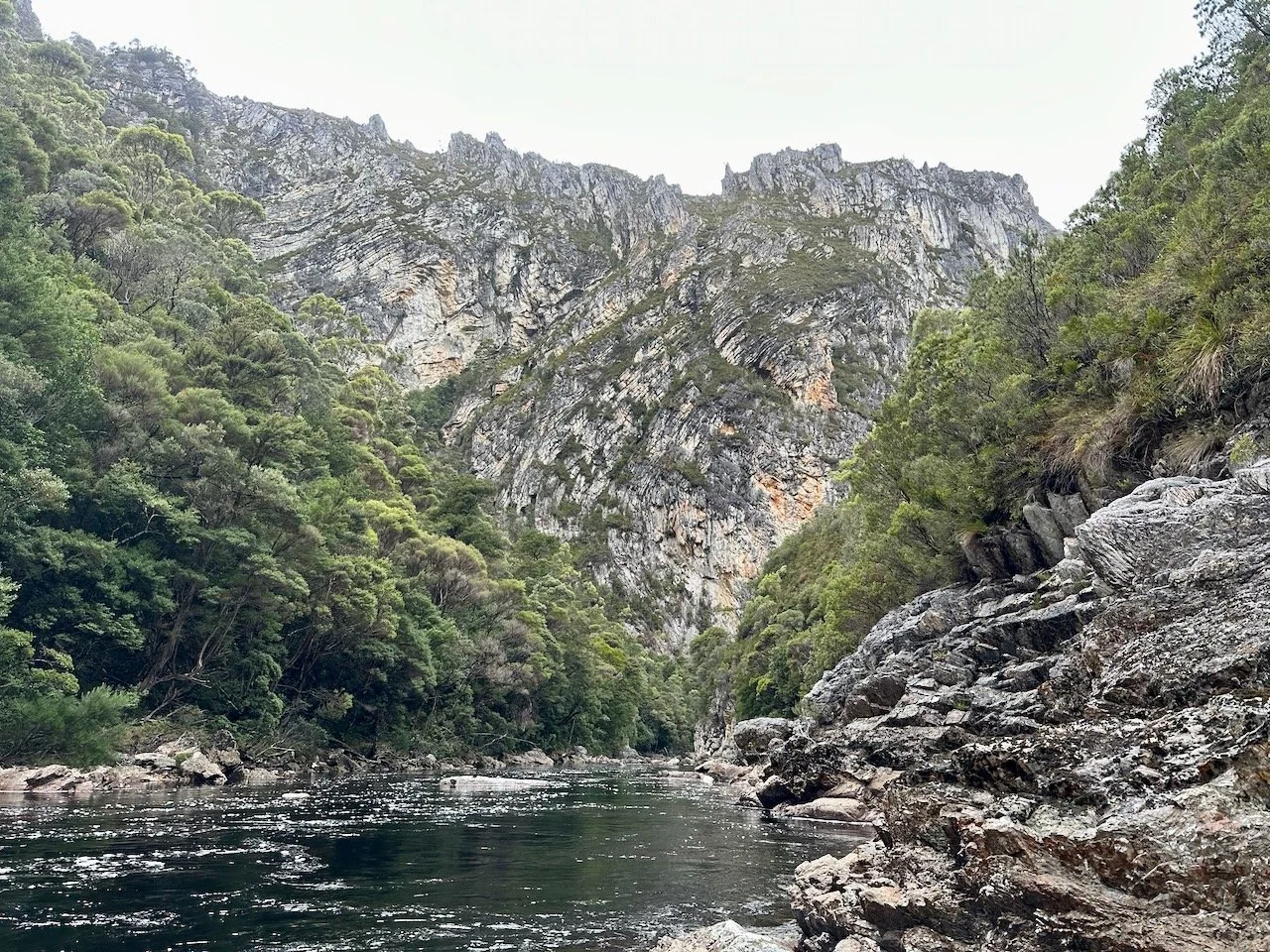
The River
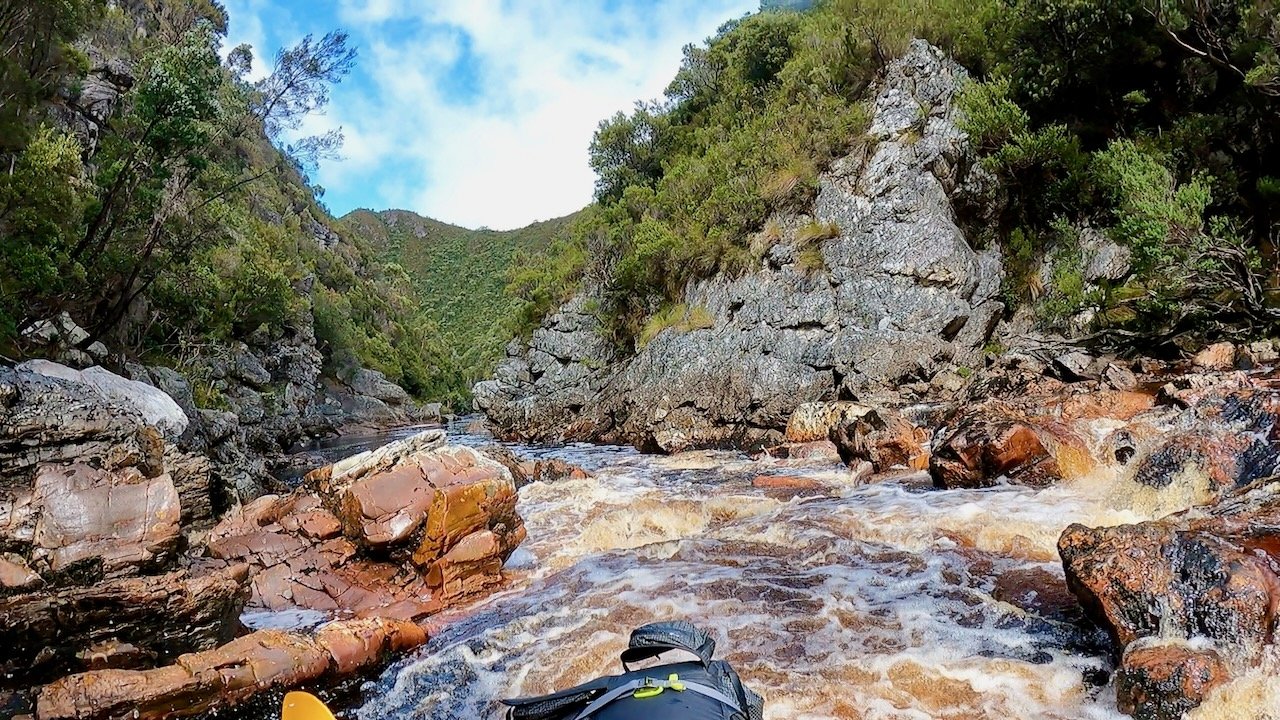
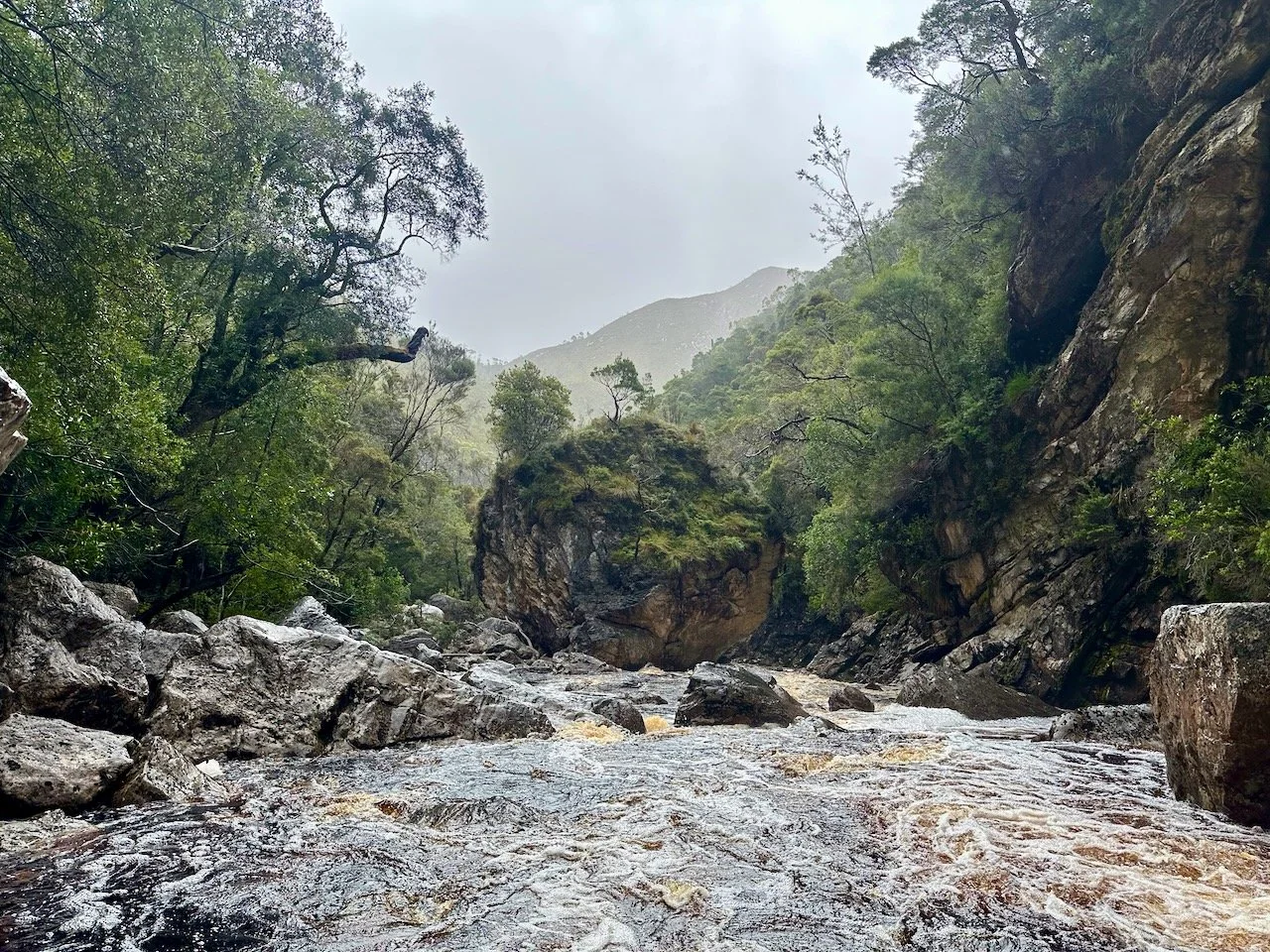
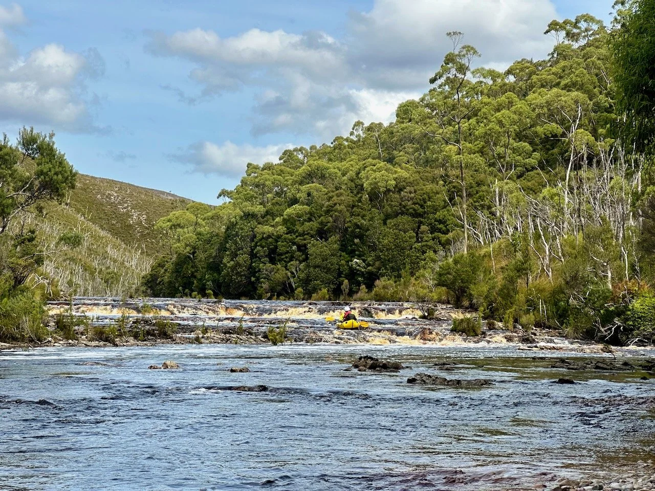
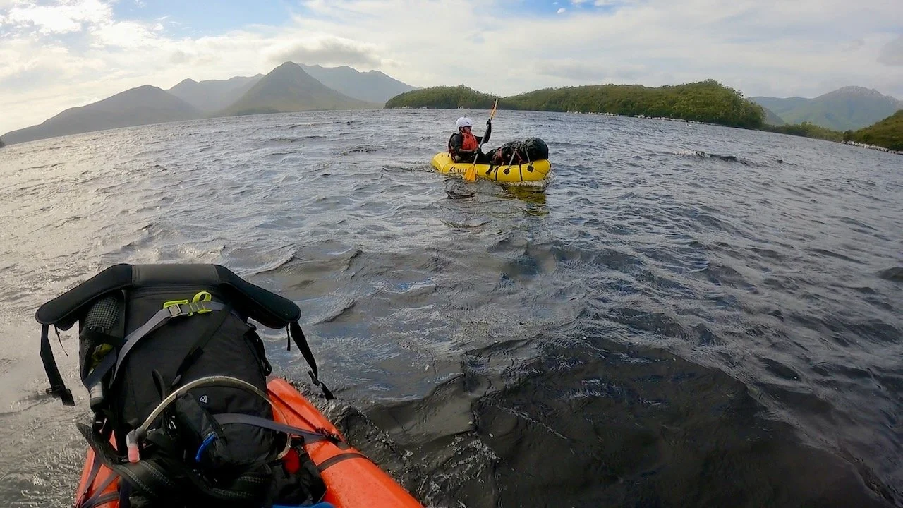
As we set off again on Tuesday morning, the revised plan was to paddle the 3.5km to the Crossing Gorge, complete the traverse of the gorge, and camp at its far end. We were optimistic about the water level, with the gauge on the Davey showing 835 Ml/day at midday the day before.
Unexpectedly, we encountered several grade 2 rapids in the initial section of the river before the gorge, which we hadn’t seen mentioned in other reports. We negotiated most of these easily, although portaged one long rocky section that looked difficult to navigate.
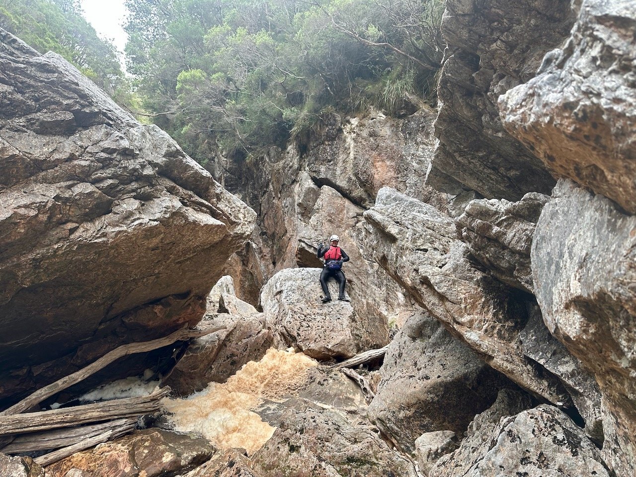
On reaching the gorge, we scouted around for a campsite we had seen another packrafter report using, but found only the tiniest of clearings at the top of a gully coming in on river left.
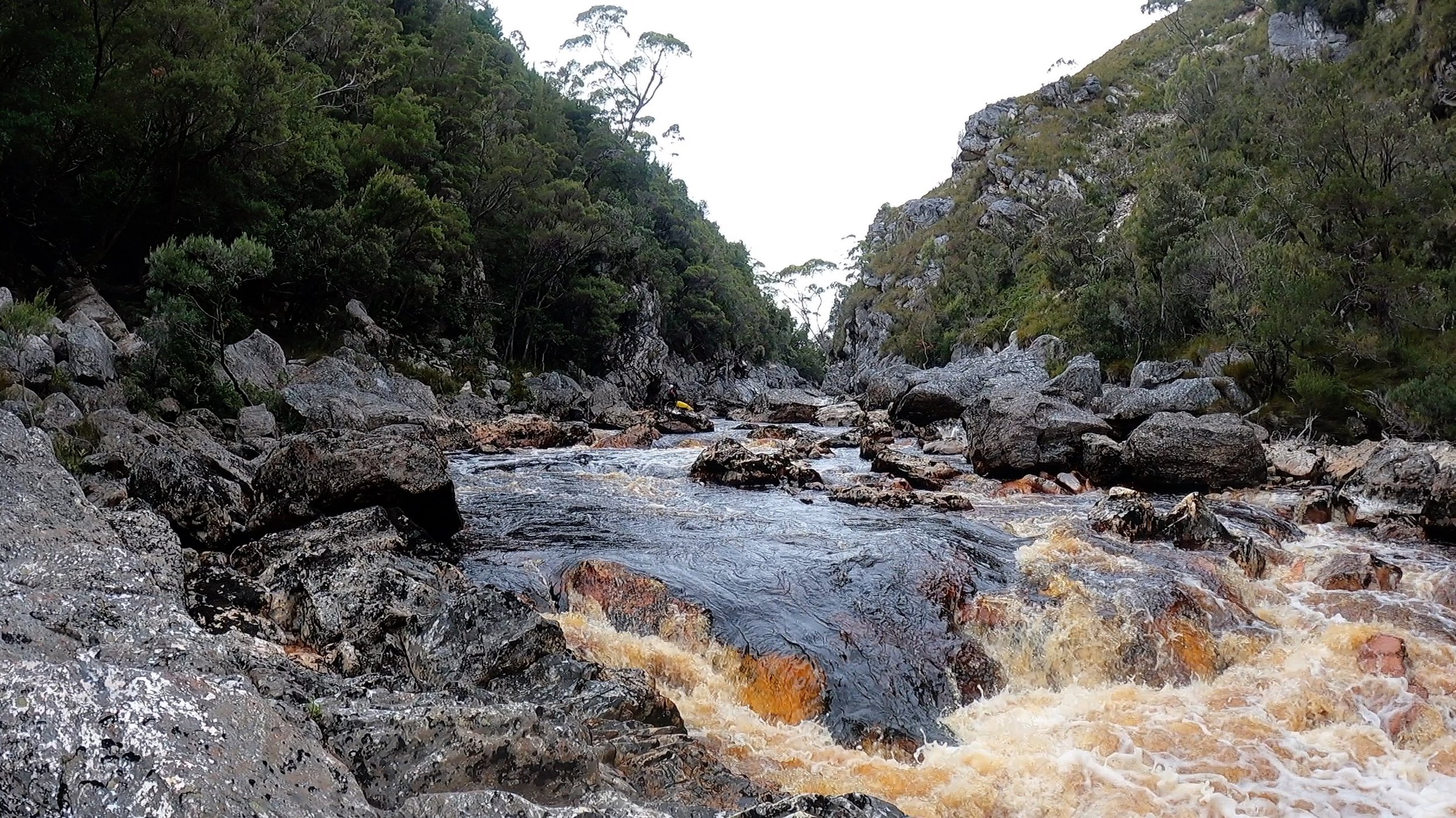
Following this we entered the first section of the gorge, where the WikiRiver guide reports grade 3 and 4 rapids are immediately encountered.
The first major rapid we encountered was blocked with a tree and required a portage (as well as being too narrow to raft).
We also portaged a second that looked a bit daunting so early in the trip.
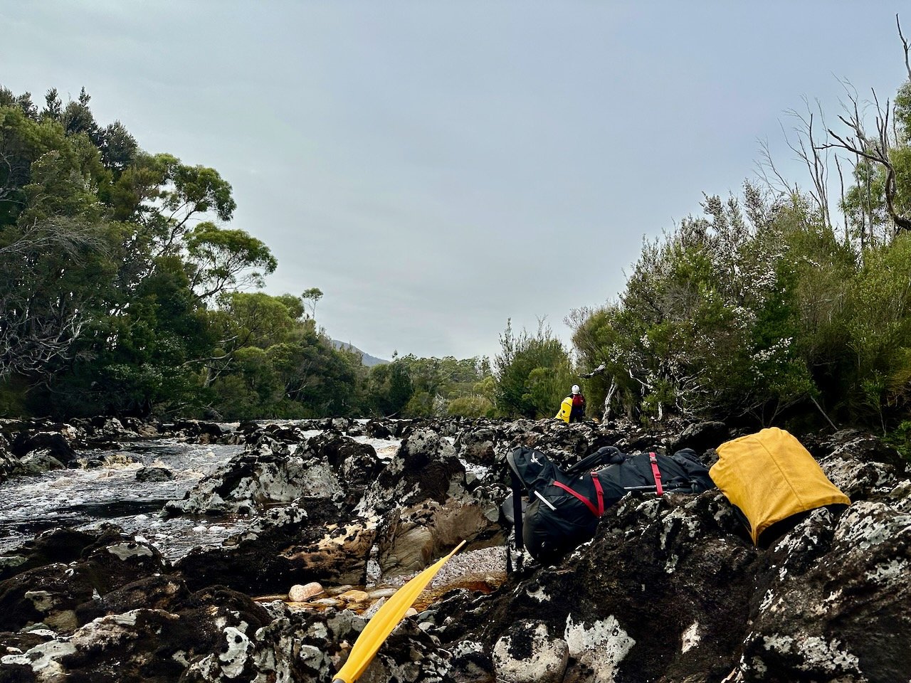
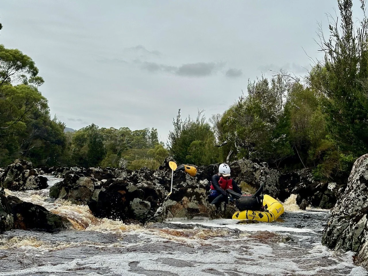
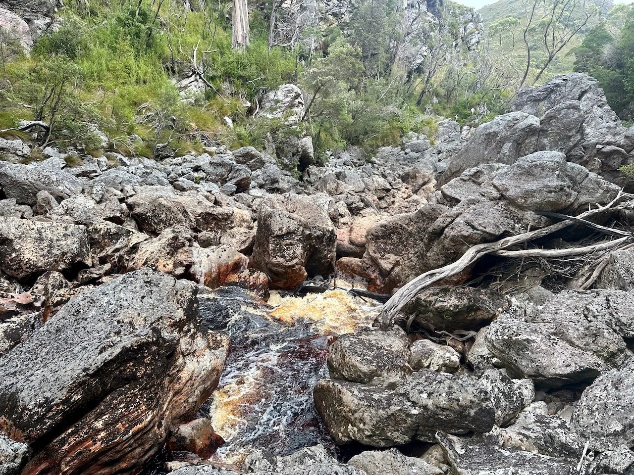
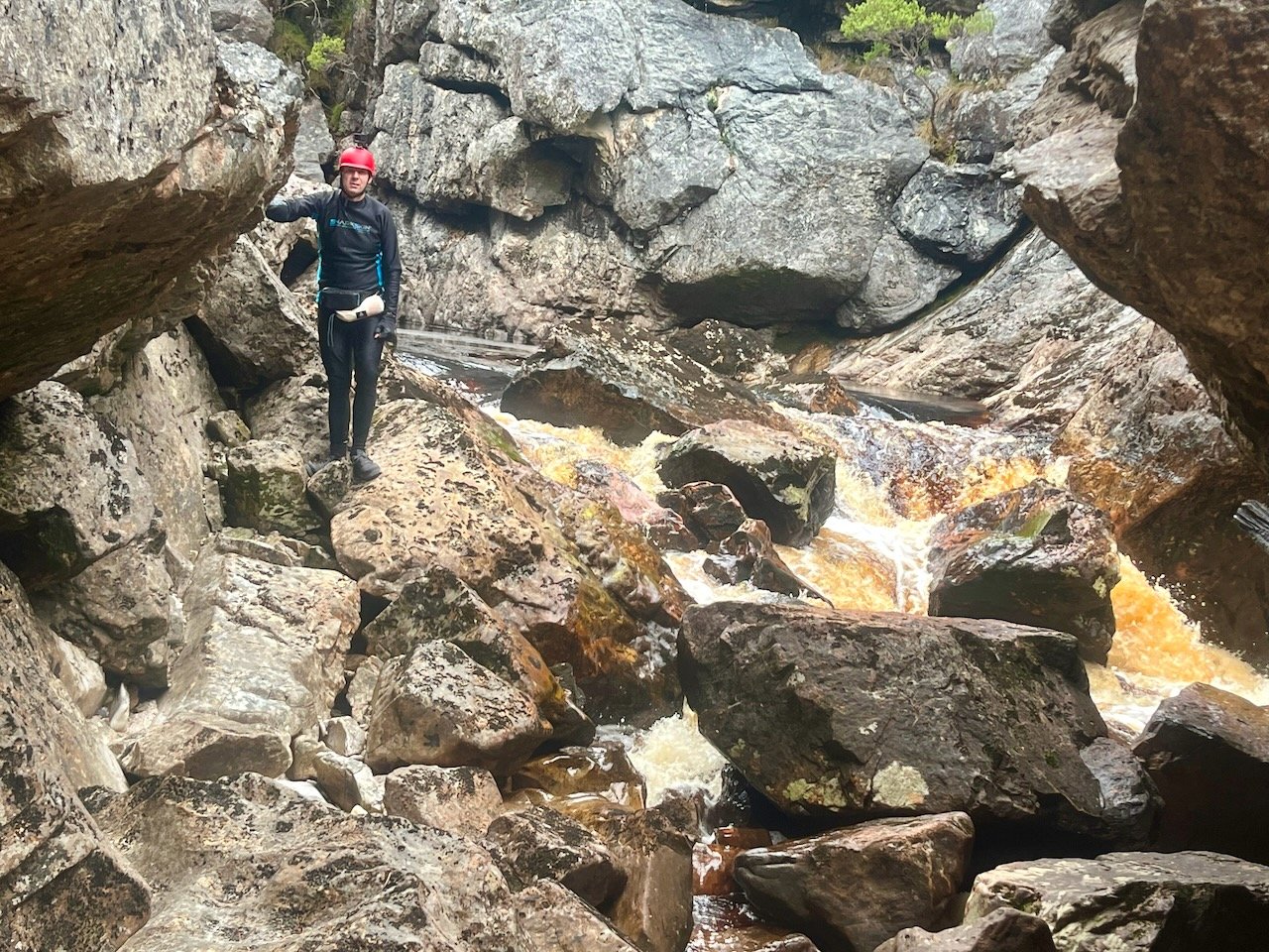
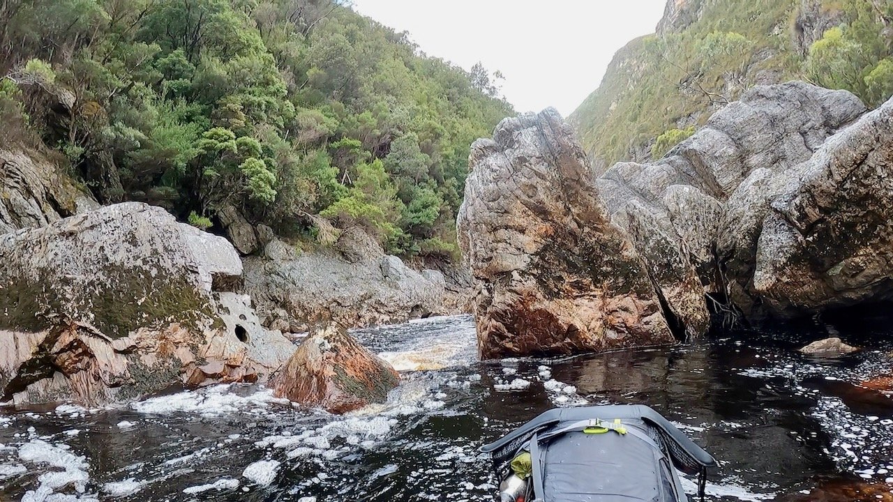
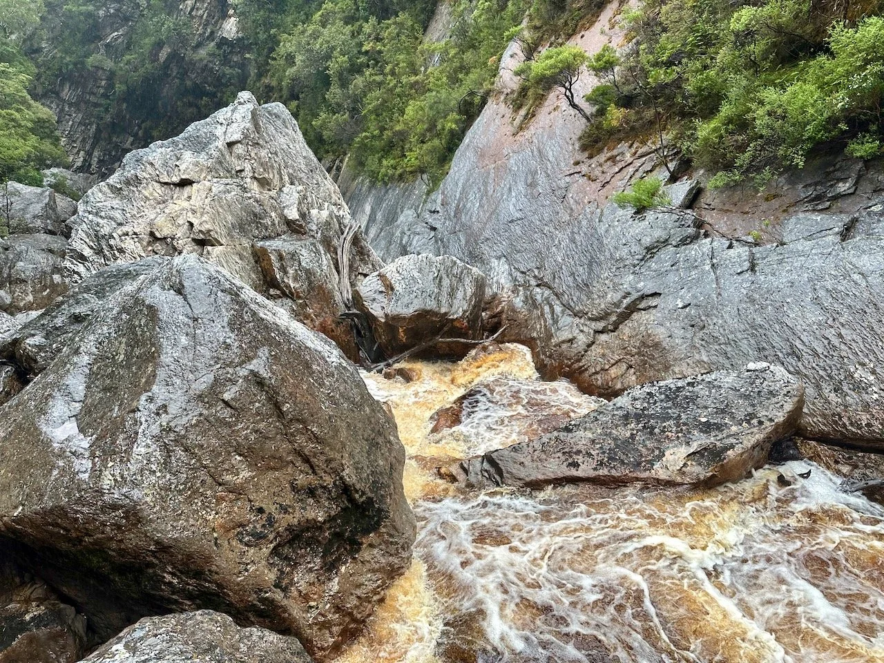
After this we didn’t encounter further rapids as such, but two complete blockages of the river by massive boulders, with bonus trees up against them, adding to the dangerous sieves they created.
We were able to portage around the first without much difficulty, but the second required us to use a poorly defined high portage track on river right that took us to the top of the gorge and back down a steep gully to the river (although this could potentially be portaged at river level with rope to lower rafts and packs, but doing so looked reasonably tricky — especially getting back into the rafts at the bottom).
First full river blockage (above) and second (below)
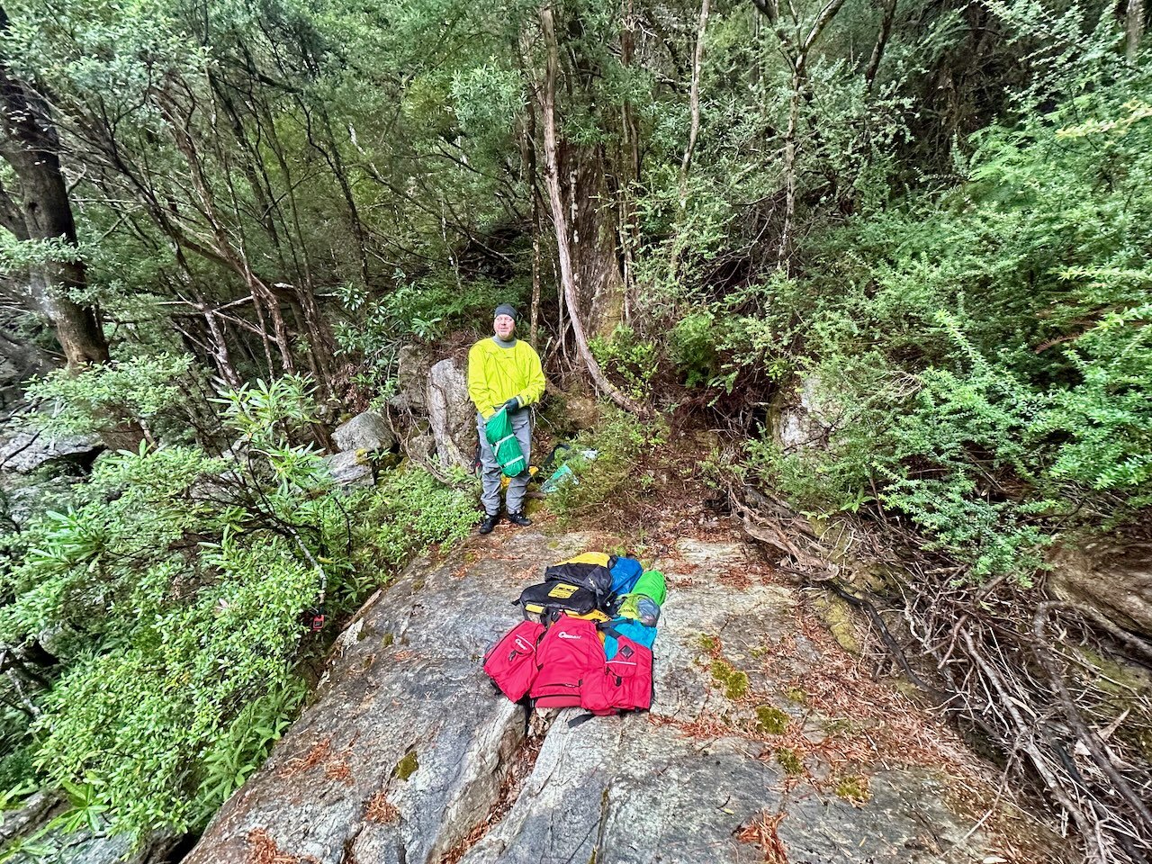
With its steepness, slipperiness, and the gear we had to get through, it was after 4pm by the time we had completed the task, so we set up camp on the shelf at the base of the portage.
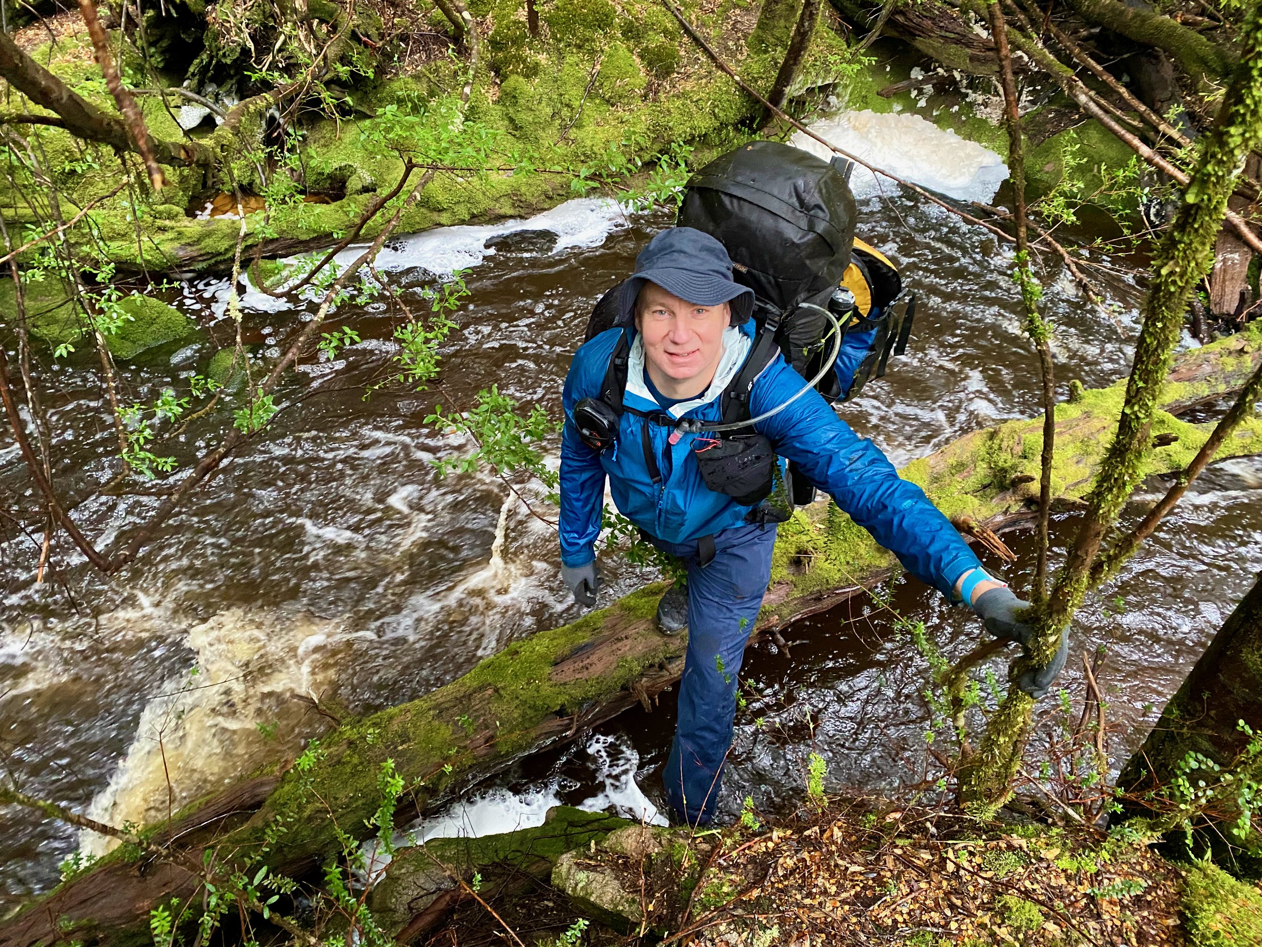
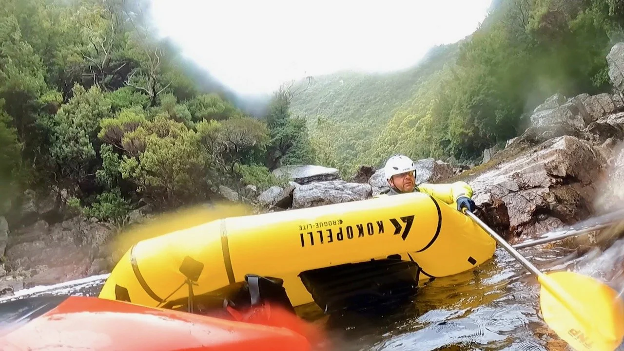
The next morning we set off down the river again, which was when we realised we had miscalculated and we’re in a little out of our depth. Where we had been expecting sections of easy paddling, broken up by a sufferfest of low water portages, we instead encountered a river that was most definitely grade 3. This was at the top end of my capability, but significantly beyond Col’s — which surprised us with the gauge reading from midday the day before showing only 717 Ml/day.
Col graciously comes on these trips so that I am able to do them, but isn’t as into packrafting as me, and this wasn’t a river I should have been inflicting on him. The result: he had many swims, which were exhausting, and induced anxiety about what lay ahead.
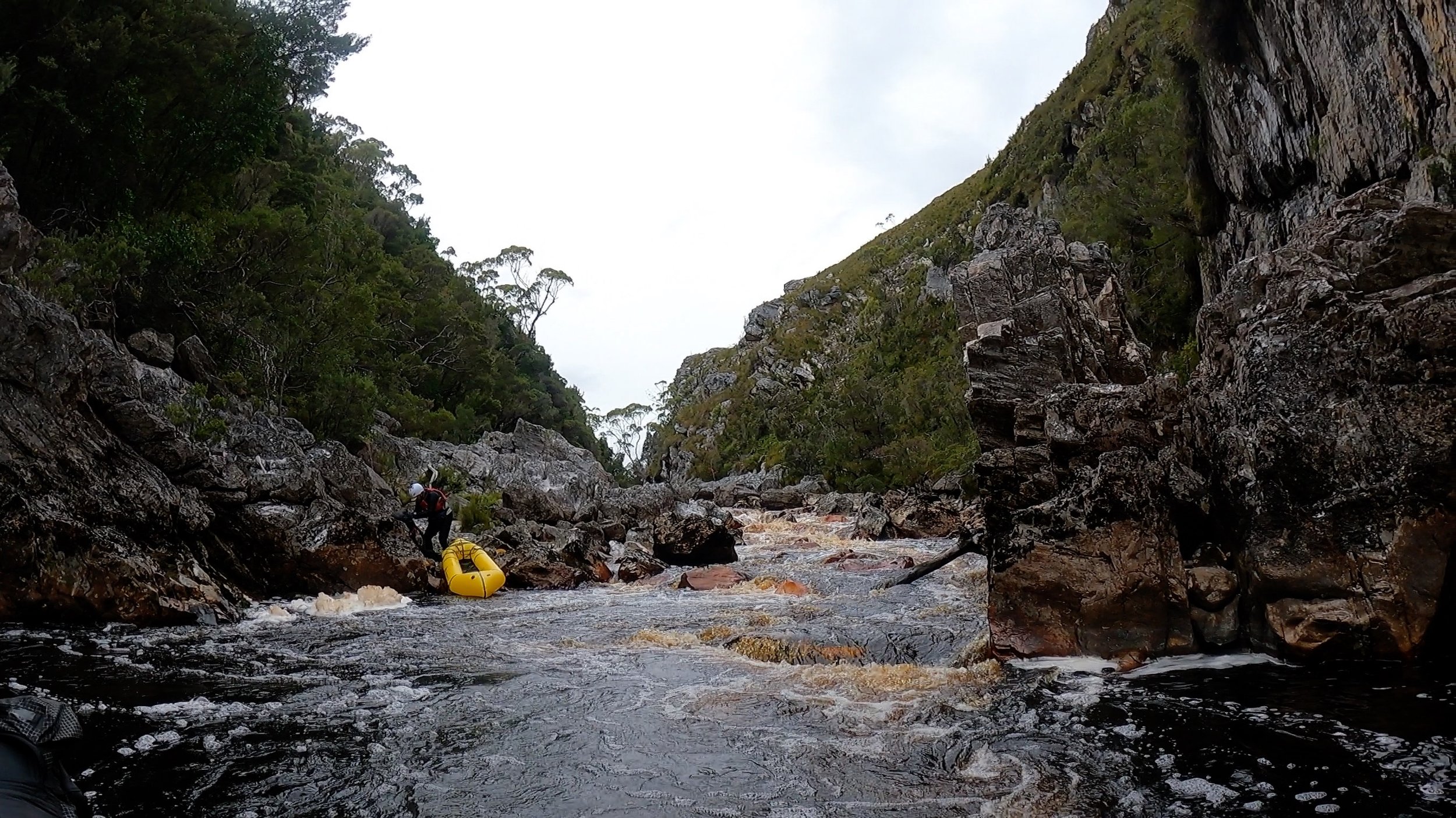
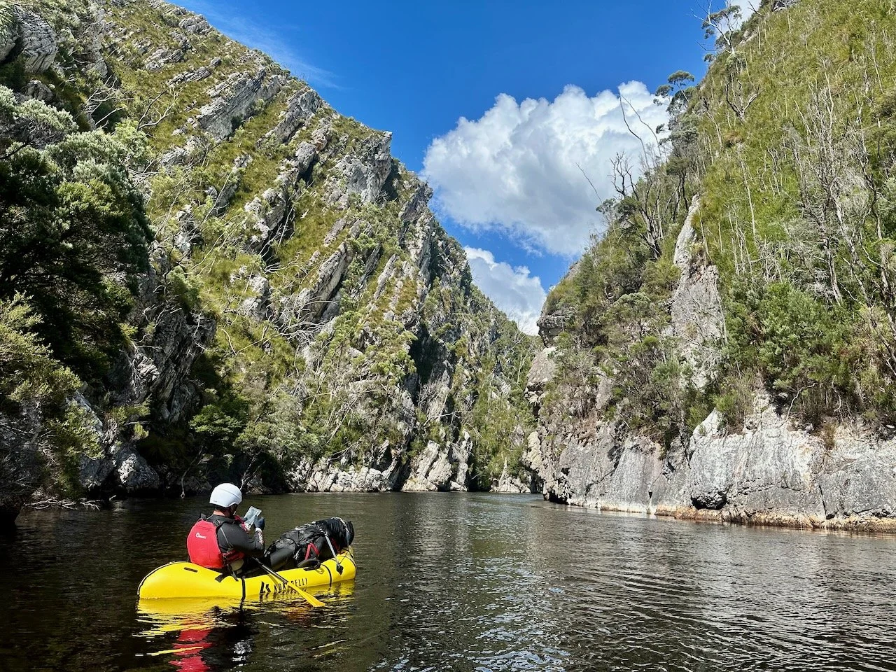
We had a brief reprieve after finishing the half kilometre of the initial section of the gorge, where the river flattens out with a number of shingle rapids, but were soon back into grade 3 rapids as we entered the second section of the gorge.
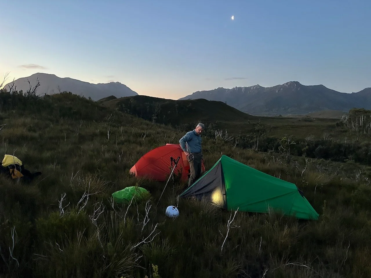
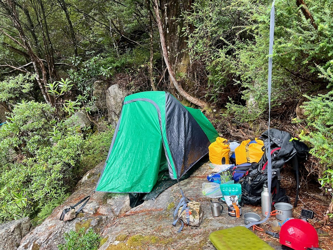
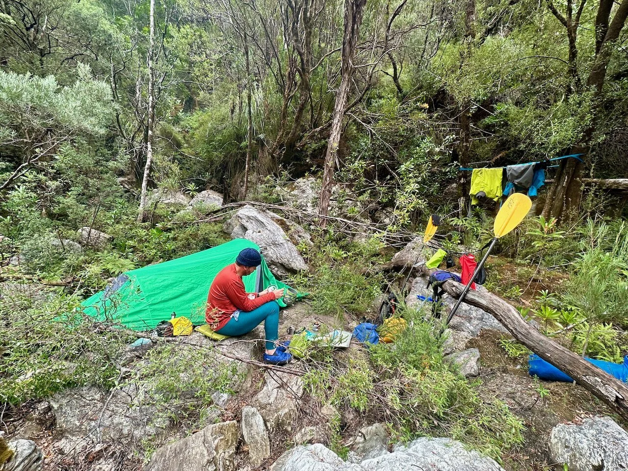
So challenging was the river, we only made it 3.6km before reaching our limit for the day. Luckily we found a big flat rock under the giant, 200 meter high, twisty wall of the gorge. The rock had a massive split down the middle, but by packing it with gear we made a site for the tent.
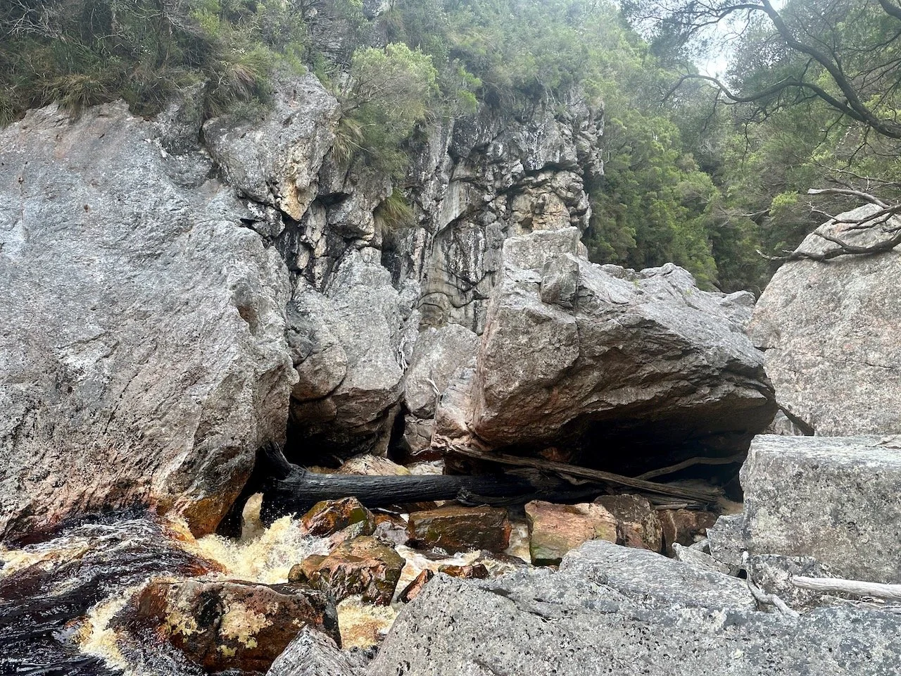
The following morning we realised what a good decision it had been to camp, when, after paddling across a still pool below our camp to scout the next rapid, we discovered another massive bolder completely blocking the river.
This was the long portage on the left mentioned in the WikiRiver guide. We assessed a route down through the rocks on river left and decided to deflate the rafts. We then began an extremely laborious task of shifting packs and rafts over the wet and slippery boulders, with big drops down as we moved forward. After hours of slow progress we reached a point where the way forward looked even worse. As I scouted ahead, I found some pink tape on a tree. I was relieved that maybe things would get easier from here, although was still dreading how we would get the gear to this point, when I discovered the marked track through the tree line went back to where we had come from!
It was a hard call whether to go back or push on. In the end we used a rope to haul the packs back a level, from where we were able to haul them up to another boulder just off the portage track. This took considerable effort, but once on the track we completed the portage much more quickly, eventually making it to another giant boulder in the river that marked the end of the portage.
By this time we had burnt more than half of the day. As we looked ahead down the river, we could see fast moving water leading to a right hand bend we couldn’t see past. We both doubted Col’s ability to catch the eddy before the bend, and the gauge reading at midday had shot up to 1,622 Ml/day.
As a result, we sought out somewhere for a tent site and made camp on a confined area of uneven rock above the river’s flow.
The next morning we woke to a gauge update, which surprised us. To this point, the website was only updating at midday each day, but the message on our Garmin InReach said the river was at 4,194 Ml/day at 4am! We were dismayed. We had been hoping for levels above 300 for the trip, but this seemed crazy high.
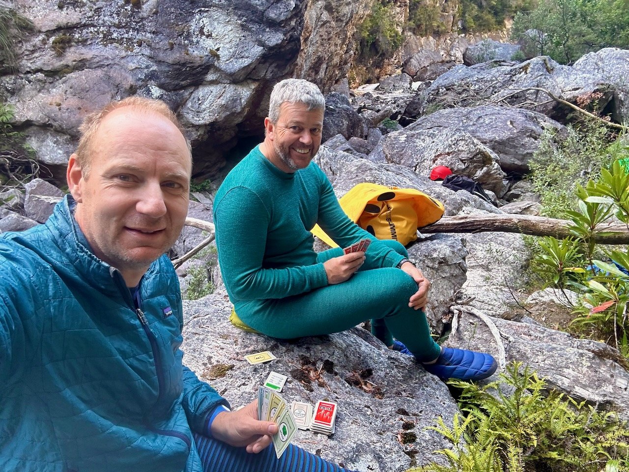
Inspecting the river, we could see it was up on the day before, and knew it would be foolish to paddle up to a corner we couldn’t see around without any hope of stopping. We made the decision to sit it out for the day, but this put us two days behind our itinerary. With no idea how long we would be stuck there, or if the river ahead was even within our capability, talk turned to EPIRBs and rescue helicopters.
I messaged my sister, who in turn reached out to John McLain and Matt Brain for me. They kindly provided feedback that we were through the worst of it and considerations for when we moved forward.
At 8am we got a gauge reading of 3,931 and at midday a reading of 3,432. The river was dropping! Extrapolating out, we hoped it would be well down by the following morning.
Thankfully that day waiting for the river to drop was sunny and not only did this buoy our spirits, but let us dry out some of our wet gear.
We slept restlessly that night, the roar of the river unsettling us and resulting in strange dreams. But the following morning we could see the river had dropped substantially, although it was still moving quickly.
We packed up camp and set off with huge trepidation. We scouted a path to the bend and an eddy before it we were confident we could both catch. From the eddy I scaled boulders to look around the bend and was relieved to see a flat pool from which we could scout further down river.
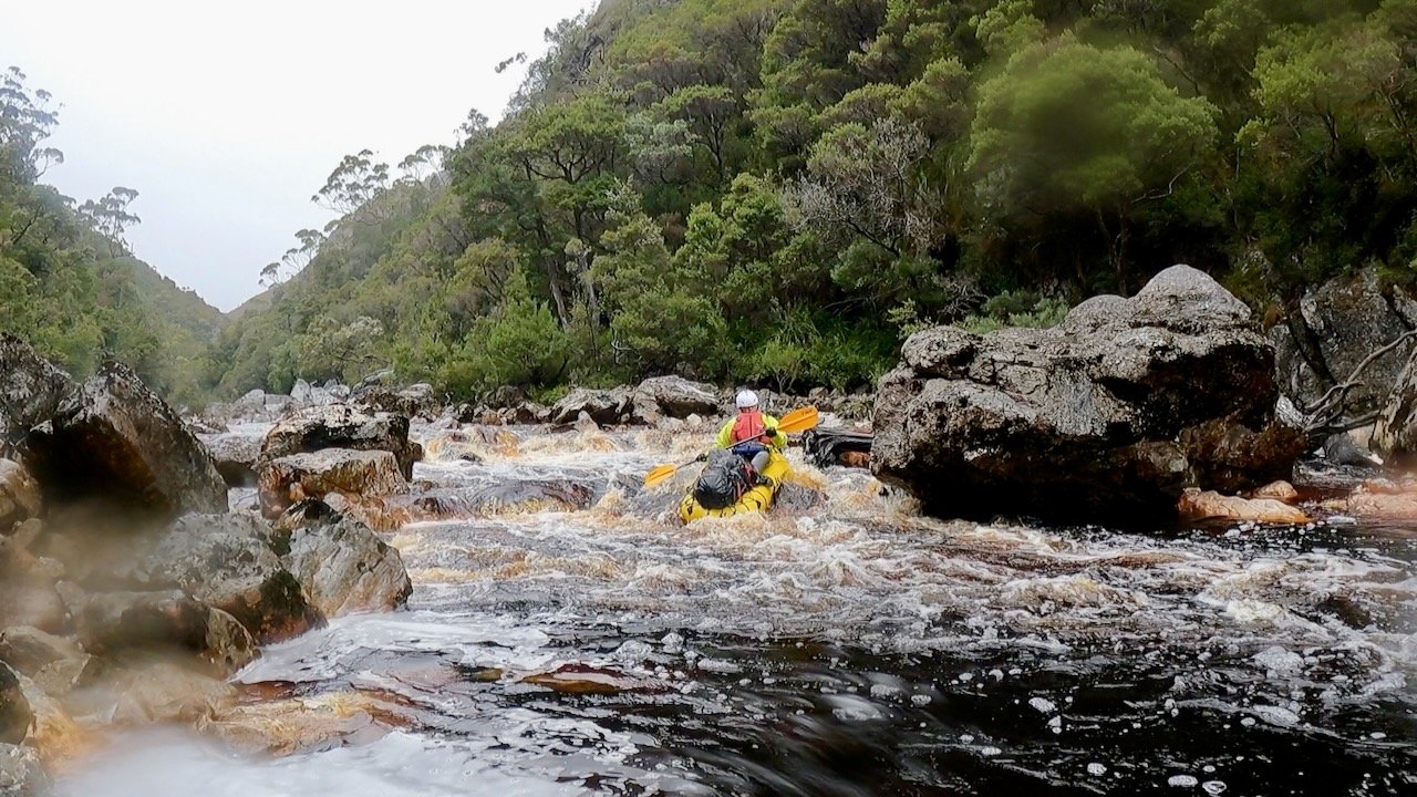
From there, we made significant progress. We had one portage from that first pool and then a couple more easy grade 3 rapids before the river flattened through another break in the gorge as the river went through a hairpin bend — where we also noticed the first Huon pines of the trip on the river bank.
Re-entering the gorge we encountered regular grade 2 rapids, all of which we paddled without issue. From there the river became easier, with long stretches of flat water, broken up by regular shingle rapids and less frequent grade 2 rapids. By this stage we were glad not to have any less water, having to pull the rafts over a couple of rapids where there wasn’t enough water to paddle down.
We continued to the end of the Crossing without issue, with the exception of a long shoot of connected grade 2 rapids just above -43.12526, 146.00458, where Col had another swim in the unexpected obstacle.
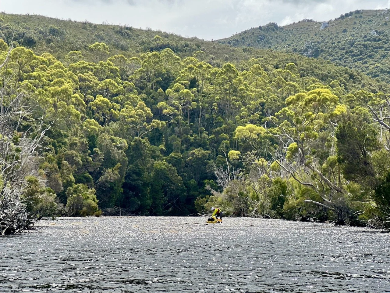
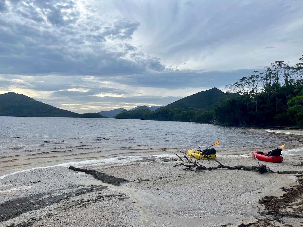
On reaching the confluence with the Davey River, the river became wide, deep, and still, with only the occasional shingle rapid to negotiate.
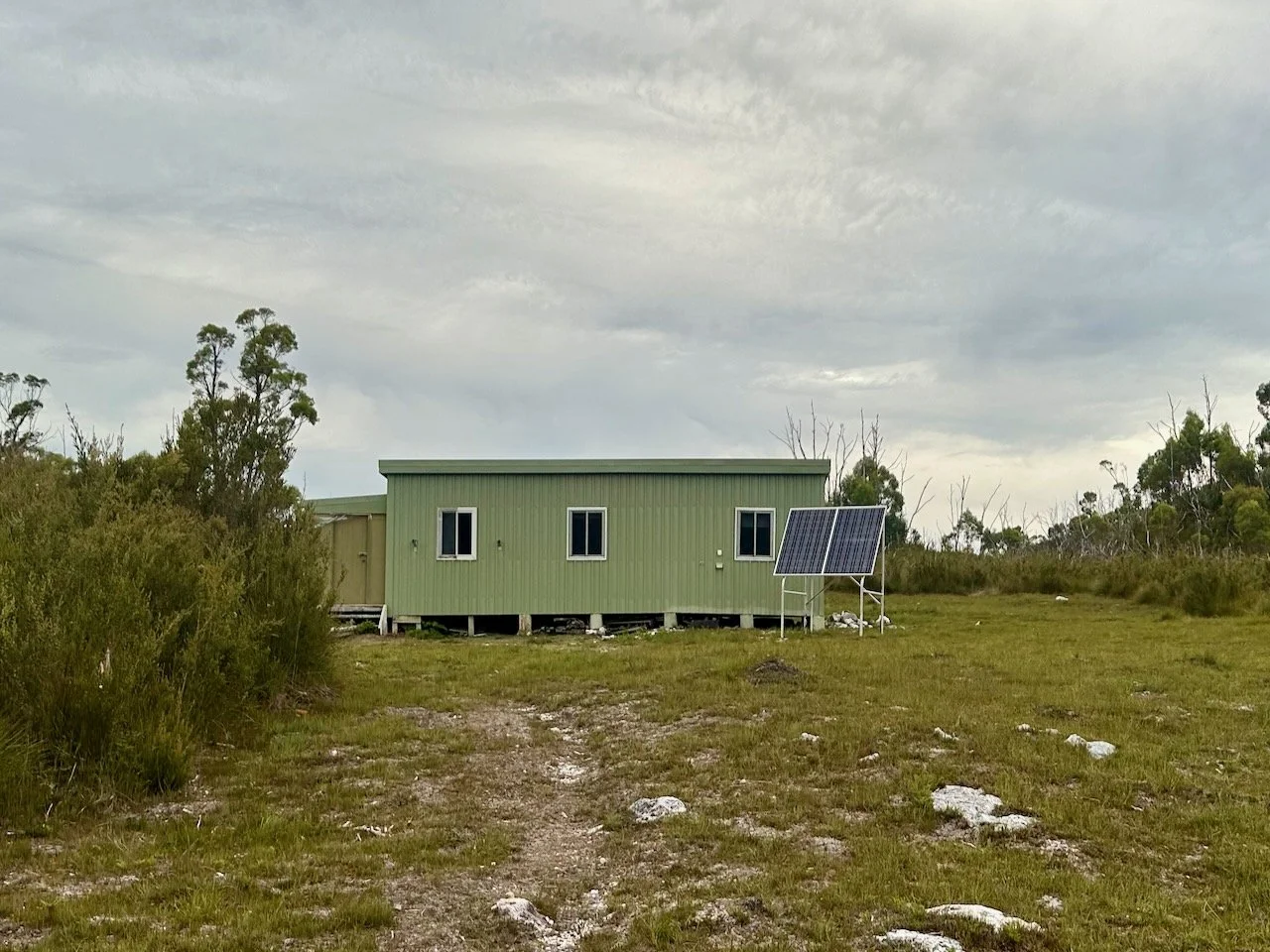
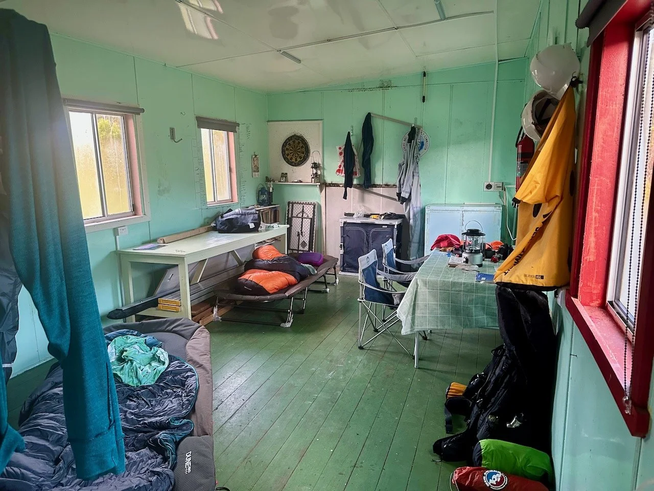
Although it was getting late, we pressed on to the hut at the water monitoring station on the Davey, arriving right on 7pm after 30km of paddling.
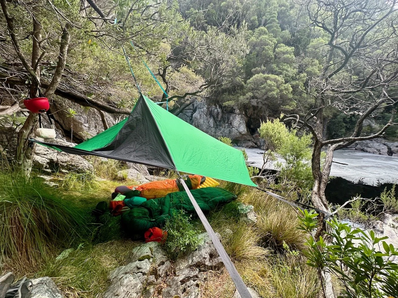
We collapsed at the hut, glad for somewhere warm and dry to sleep, and for the cots that beat sleeping on uneven ground as we had the past several nights. If only the electric lights had worked as well, it would have been paradise, but the solar system appeared to have been disabled.
The next morning we had good weather, but were conscious of a forecast that was bleak for the following days. We considered our options and remaining food and briefly speculated about chartering a helicopter to take us out. But with a limited window to paddle, we decided we couldn’t wait and needed to make it down to Settlement Point and on to Heather Bay.
The weather forecast meant our hopes of paddling Port Davey were done. Instead we needed to make it to Heather Bay so that we could hike over the Lost World Plateau to the Port Davey Track and start down it to Melaleuca — a task we were dreading with our heavy packs.
We set out on the river, immediately encountering unexpected grade 2 rapids in the Davey Gorge, which I hadn’t seen mentioned in other reports. These weren’t especially challenging, but somehow I ended up having my second swim of the trip on the last of them, while Col made it through unscathed.
In the roar of the rapids, Col thought he imagined the sound of an outboard motor, but as we rounded a corner we found two young guys in a tinny making their way upstream. We stopped for a chat, they being the fist people we had seen in a week. They had come from a larger boat and were trying to get up to the hut we had stayed in to check it out.
Given our predicament, we unashamedly asked about a lift to Melaleuca, but it was not were they were headed. We left them to trying to get the tinny upstream over rapids and we continued down river.
Within a few hundred meters though the rapids were done and flat water extended before us through the impressive gorge.
Post the gorge the paddling became a slog as we reached sea level. The river was wide with no real flow and the increasing wind dramatically impacted on our speed depending on whether it was in front or behind us as we made our way through the river’s bends.
But within an hour we head the sounds of an outboard again as the two young guys we had met earlier returned downstream. They hadn’t made it to the hut, but stopped to say they could take us to Schooner Cove if we wanted. After a quick map check and the promise that it was only an hours travel in their larger boat, we gladly accepted. We threw our packs and half deflated rafts into the tinny and jumped in.
Not only had these two young guys — brothers Keegan and Tyler — come to our rescue, but they offered us beers and Cheezels on the ride to their retired 50ft fishing boat: the Yimbala. Legends!
Port Davey
Aboard the bigger vessel, anchored off Settlement Point, we made quick time to Schooner Bay in the Bathurst Channel, with the wind starting picking up speed. It was then back into the tinny with Tyler, who went above and beyond, taking us east through Bathurst Channel to minimise our remaining paddling.
He dropped us on a small beach on the northern shore of the channel, and after goodbyes, we quickly re-inflated the rafts. We set off south to cross the channel in the increasing wind and swell, ultimately having to make our course more easterly to avoid the waves. Thankfully the wind was at our back.
We continued into Horseshoe Inlet, barely having to paddle thanks to the wind, making landfall at the end of the inlet just prior to 5:30pm. A quick search from the beach revealed an existing campsite behind a wall of sticks, with a marked track apparently leading to the Port Davey Track.
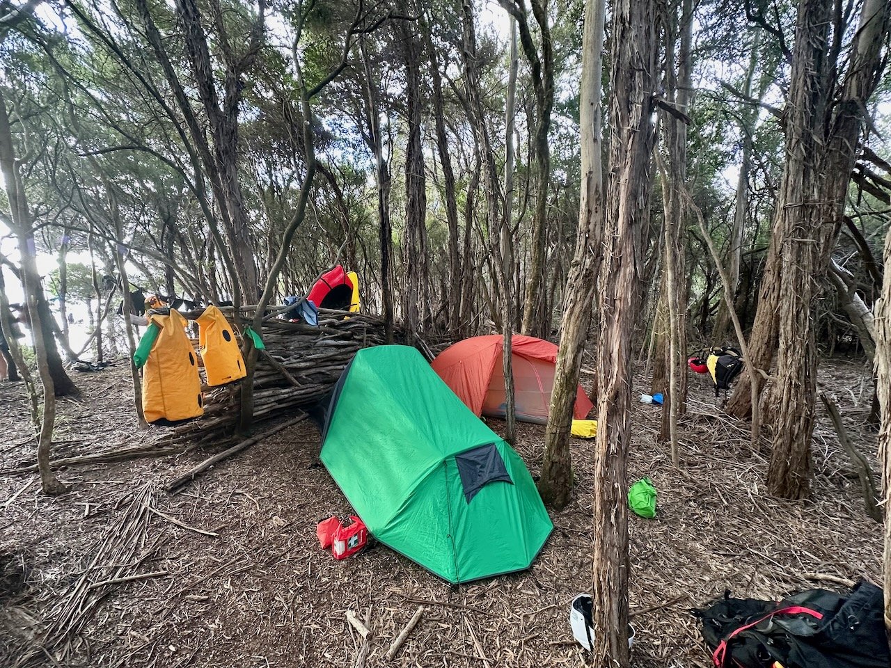
We took the opportunity of the remaining day to hang all of our gear to dry in the wind, while we setup camp and had dinner. With rain forecast overnight we then had to pack it all away again before climbing into bed.
The overnight rain wasn’t too bad, and held off in the morning to allow us to pack up camp. We then made our way up the rough track from the rear of the campsite to the Port Davey Track.
Port Davey Track – South of the Narrows
We estimated we had 8km to walk to Melaleuca, but this turned out to be closer to 11km in horrendous squalls of wind and rain on a track that more frequently resembled a giant muddy bog.
Cold, wet, and defeated, we made it to Melaleuca about 3pm, where thankfully one of the two walker huts was empty. We collapsed into the hut, glad to be out of the wind and rain, but unfortunately not out of the cold. Although we didn’t know it at the time, we would barely leave this hut over the following four days as Melaleuca was pummelled with the most ferocious weather. We had wind, rain, hail, and lightning, with the forecast at one stage showing a ‘feels like’ temperature of -8.3°C during the day (and although we didn’t know it at the time, the Davey River gauge shot up to a whopping 23,400 Ml/day).
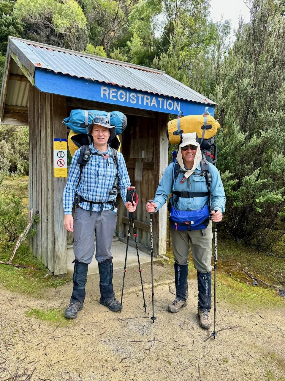
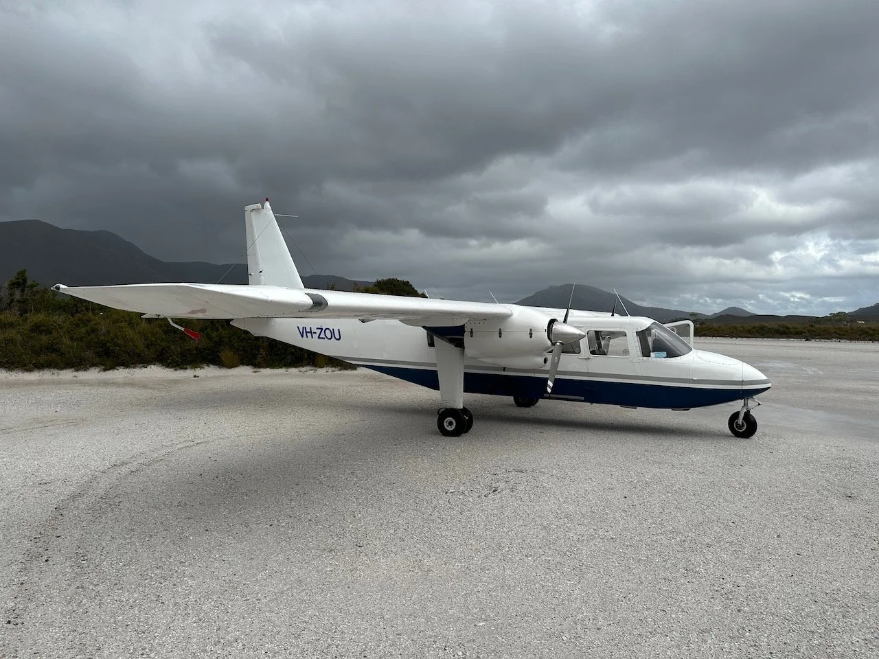
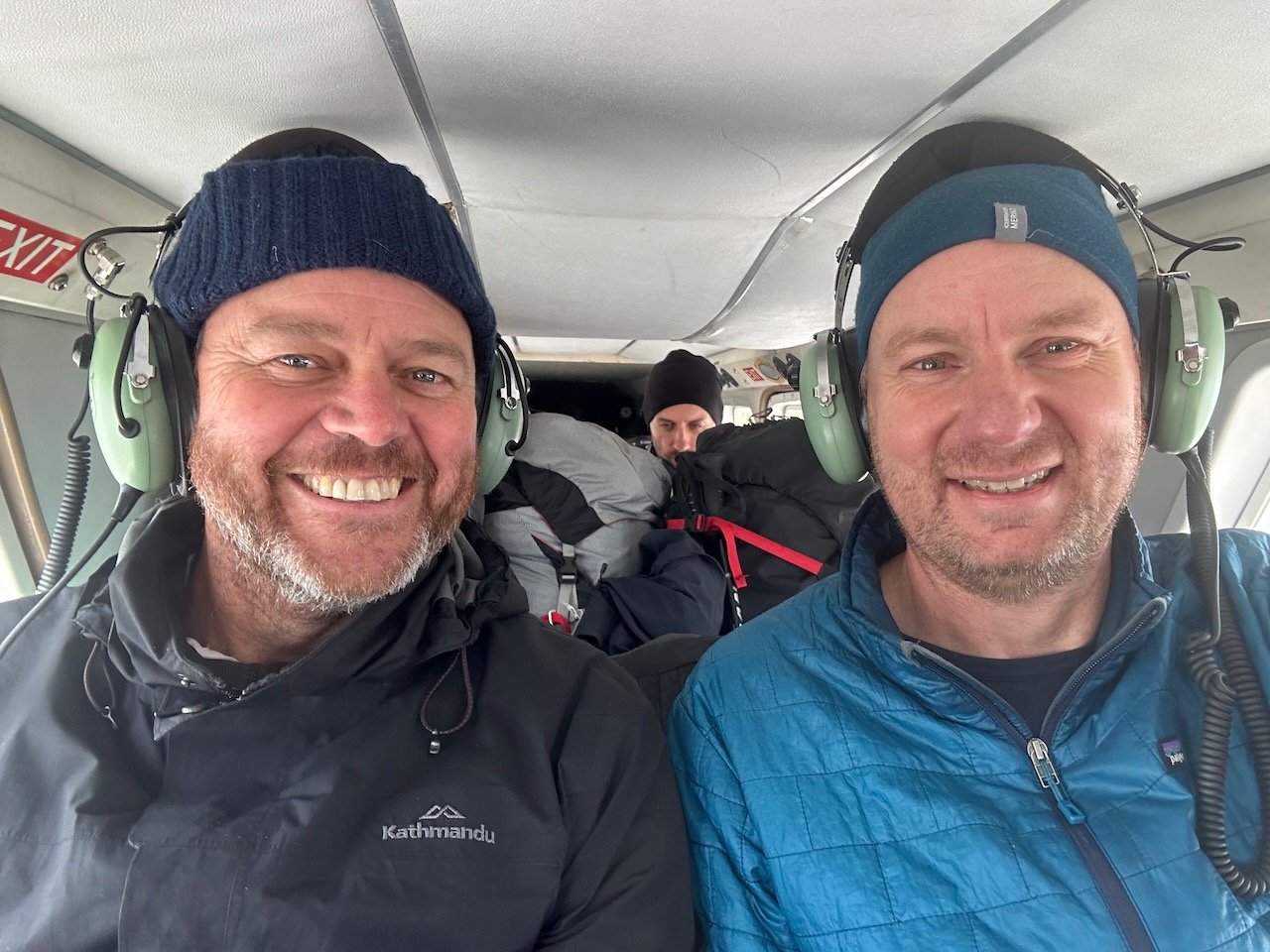
Needless to say, we abandoned our plans to continue on with the South Coast Track and instead spent our days enjoying our pre-arranged food drop that had been waiting for us at Melaleuca until the weather improved enough for flights to resume. Sadly, we couldn’t get on the first plane on the Thursday, and had to wait until Friday, when our hopes were again dashed as the plane that arrived was grounded by the weather. But the following morning, five days after our arrival in Melaleuca, we were finally able to get out.
Epilogue
In hindsight, the trip was an epic adventure that we are glad to have achieved. But one we probably shouldn’t have attempted — although water levels and weather were a significant factor in this.
For anyone else considering the trip, don’t underestimate the grade 3(p) rating of the Crossing, and be mindful that the gauge readings are probably indicative of the level of the Crossing from the day before. When the water levels are going up, it probably won’t be reflected by the gauge until the following day.